Friday 27th January 2017 Cranberry Rock - Brockton (9 miles) 6 miles!
Cold, but with a reasonable forecast, we set off early for Brockton ready to resume the route at Cranberry Rock. reached Brockton in good time and set off on short hop back to Cranberry Rock.
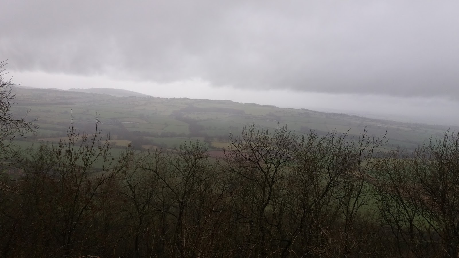
What a difference in climate from Brockton to Cranberry! Everything at Cranberry had a thick covering of frost - absolutely beautiful - but hardly conducive to walking and a thick blanket of fog/mist blotted out the views!
We kitted up and started up the wide, well-worn track to Cranberry, but it soon became obvious that continuing was not sensible. The fog made it impossible to locate landmarks and judge distances and the cold was biting. We retraced our steps and headed back to the car, where we decided to head down to the village of Stiperstones to the pub! We had three choices - go home, move onto our next planned section to Welshpool or continue with todays route, missing out the high, exposed ridge.
At the pub, unfortunately closed, the weather was much warmer and clearer, so our best option was to walk on from there. We will go back and walk the ridge from Cranberry Rock to the Stiperstones Inn another day.
Fortunately, the route takes you right past the pub, so we were straight back on course, once suitable thawed. From the main road, you take a track opposite the school, off over a ford, towards Buxton Wood. Here I realised I'd forgotten to start my tracker , which then promptly resumed our initial foray at Cranberry Rock and creatively filled the car journey with a straight line! Some cunning IT juggling needed to sort that out!
Climbing up through the wood, you then take a bridleway around the edge of Lower Santley Wood before dropping down across farmland. This was a well walked route and easy to follow. The route rises and drops onto a lane and then heads uphill on a track to the top edge of another steepp wooded slope. Fortunstely, most of the climb has already been done so you just get the benefit of the scenery!
As you drop down, you leave the woods, through fields to cross the A488, passing through Hope. You see little of Hope as you crosss straight over and continue on, but you do go through someone's garden. They've obviously embraced having a right of way over their land, providing a grassy area with animal statues and painting the pedestrian gates and bridge bright purple!
Through the purple gate and over the purple bridge takes you on a wooded footpath to the cemetary wall, and a church! There must be another accesss point! Holy Trinity is a tiny church with a bell tower seemingly in the middle of a wood!
Soon after, you pop out onto a lane and continue to follow lanes to Bromlow Callow, who sounds like a character from a Victorian novel! It is in fact a rather perfectly shaped hill with a top-knot of trees - a very distinctive landmark for miles around.
As you run out of lane and revert to track, you begin the climb up Bromlow Callow. \a bit steep, but you don't climb all the way to the summit, you meet a lane and follow this around the hill to Abel's Harp, a very welcoming Inn, vintage shop and accommodation. The pub wasn't actually open, but they were happy to serve us coffee and we had a very welcome picnic on the benches outside.
Suitably refreshed, we headed down the lane, reassuringly signposted Brockton, with what would be stunning views on a clearer day. Although clear, the day remained dull and murky and chilly!
Rather than follow the lane all the way to Brockton, the route cuts a corner off by heading once again over fields. Initially grassland, you cross several ditches or streams (all have bridges!) and then crops. Again, due to the time of year, no pathway was visble, so off we went heading for the best landmark. Just as we were congratulating the farmer for his excellent drainage, we hit claggy soil, so ten tonne boots again.! Yuk!
Luckily after this section, you meet a farm track, which takes you back to the lane just outside Brockton, giving the opportunity to unload your boots! After a bit of technical jiggery pokery, we'd covered about 6 miles of the route. We'll return to the ridge in better weather!
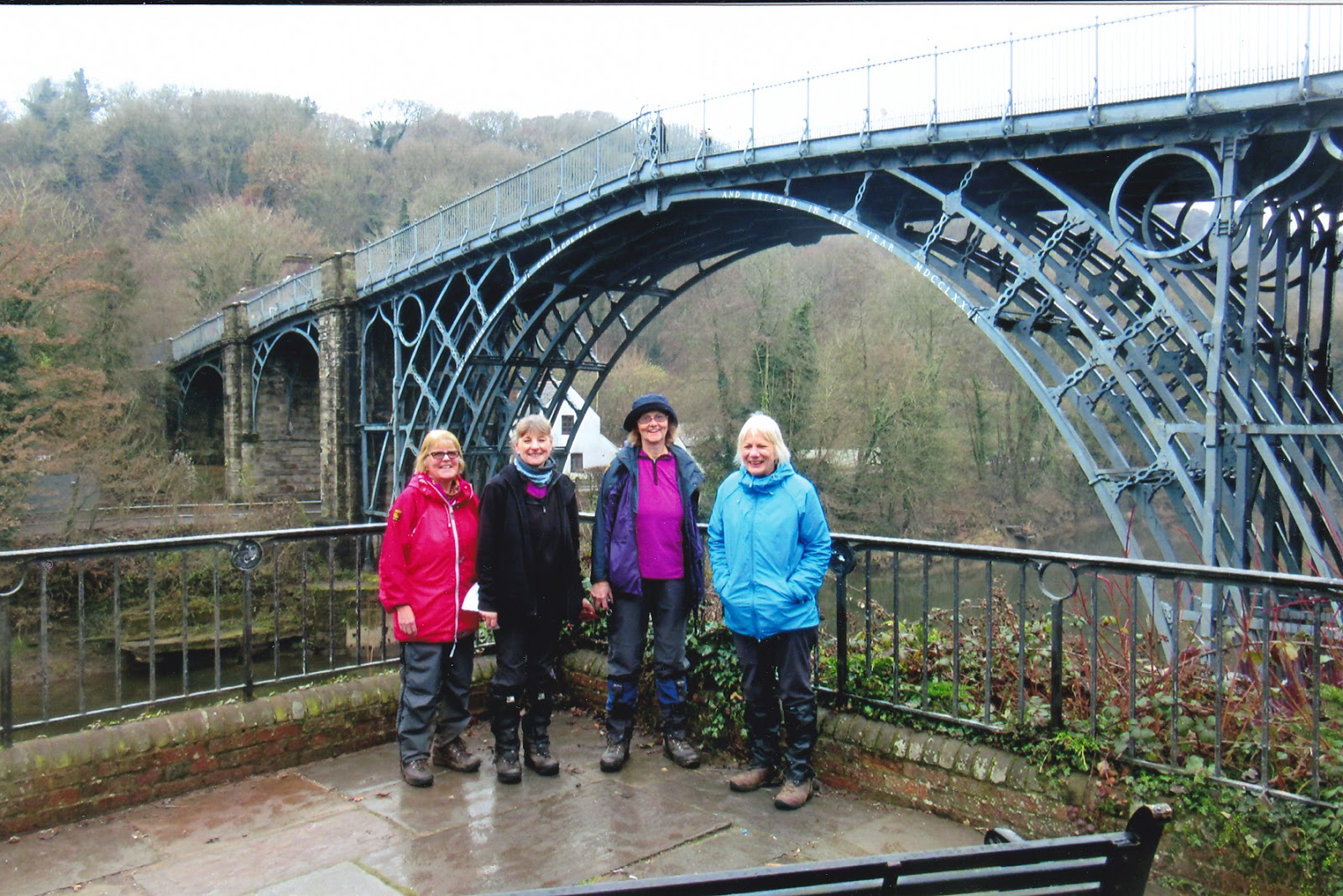
Photos to follow - I didn't take one! What with my technical nightmare with route mapping, I thought I'd leave photos well alone (and my fingers were cold enough anyway!)
Monday 23rd January 2017 - Church Stretton - Cranberry Rock - 6.8 miles
This section (and the next) take us up and over the Shropshire Hills, so we've planned shorter walks to allow for all the climbing, the longer transfer times to the middle of nowhere and less time out in exposed areas if the weather threatens.
The forecast was for freezing fog (great) which might or might not lift! We decided to go and look, our transfer drive through the hills would give the best indication.
We set off in murk, which then became murkier and then miraculously cleared as we reached the hills. By the time we'd done the transfer and were ready to walk, it was a glorious day.
Thankfully, the bearings and timings I'd attempted in case fog descended weren't going to be needed.
We'd walked into the Cardingmill Valley on the last section to get as close to the hills as possible, but we'd left plenty of the flatter section past the National Trust offices and Tea Room to warm our legs up for the climb.
This actually wasn't as bad as remembered - its a well worn path, so you don't have to worry about where to go - its just up! If that wasn't enough, the whole world seemed intent on ringing me on the way - I thought you lost signal in the hills!
Anyway, we finally made it to the top of Motts Road, where we bumped into another of our Ironbridge walking friends out recce'ing a walk for Bishop's Castle Walking Festival! Its a small world!
From the top of Motts Road, you wlk along the top of the Long Mynd ridge towards Shooting Box. This is a small green hillock which was most recently used as a shelter for shooting parties out on The Mynd, but was originally a Bronze Age burial mound.
Just below Shooting Box, you meet one of the few lanes crossing The Mynd, but you then head off down a bridleway, which gradually takes you down off The Mynd to Coates Farm. This starts as a wide grassy track - easy walking with super views (very exposed if weather nasty!). Eventually, it turns into more of a farm track - currently rather muddy - and you start to meet the odd tree as you lose height. It's a cracking route, easy to follow, on a clear day. We even spotted a Red Kite soaring!!
Finally, you reach Coates Farm and walk through the farm to head towards the Overs - Upper and Lower - two farms from what we could make out!
Here our pace slowed to accommodate the digger with huge caterpillar tracks that was filling the lane! We had no choice but to follow it all the way into Bridges. We finally managed to sneak past as the road widened by the pub, which seemed prophetic, so we stopped for coffee and our sandwiches!
After lunch, my promise of a gentle, undulating climb to Cranberry Rock was fulfilled, but not before the steep drag up to the Stiperstones cattle grid! I'd forgotten about that! The route follows the road, but it's still a pull up out of Bridges!
When you cross the cattle grid into the Stiperstones, the land opens up again, with the Long Mynd behind you, the Stiperstones in front of you, and big rolling hills all around. It's beautiful.
The lane takes you all the way to the car park at the base of Cranberry Rock, so you can fully enjoy the views as you walk! The weather was still lovely and we reached Cranberry Rock in good time.
As it turned out, we could have gone further today, but you never can tell. It would have been rather different in the fog , or a gale, or driving rain, or a blizzard - all of which are local specialities.
This section (and the next) take us up and over the Shropshire Hills, so we've planned shorter walks to allow for all the climbing, the longer transfer times to the middle of nowhere and less time out in exposed areas if the weather threatens.
The forecast was for freezing fog (great) which might or might not lift! We decided to go and look, our transfer drive through the hills would give the best indication.
We set off in murk, which then became murkier and then miraculously cleared as we reached the hills. By the time we'd done the transfer and were ready to walk, it was a glorious day.
Thankfully, the bearings and timings I'd attempted in case fog descended weren't going to be needed.
We'd walked into the Cardingmill Valley on the last section to get as close to the hills as possible, but we'd left plenty of the flatter section past the National Trust offices and Tea Room to warm our legs up for the climb.
This actually wasn't as bad as remembered - its a well worn path, so you don't have to worry about where to go - its just up! If that wasn't enough, the whole world seemed intent on ringing me on the way - I thought you lost signal in the hills!
Anyway, we finally made it to the top of Motts Road, where we bumped into another of our Ironbridge walking friends out recce'ing a walk for Bishop's Castle Walking Festival! Its a small world!
From the top of Motts Road, you wlk along the top of the Long Mynd ridge towards Shooting Box. This is a small green hillock which was most recently used as a shelter for shooting parties out on The Mynd, but was originally a Bronze Age burial mound.
Just below Shooting Box, you meet one of the few lanes crossing The Mynd, but you then head off down a bridleway, which gradually takes you down off The Mynd to Coates Farm. This starts as a wide grassy track - easy walking with super views (very exposed if weather nasty!). Eventually, it turns into more of a farm track - currently rather muddy - and you start to meet the odd tree as you lose height. It's a cracking route, easy to follow, on a clear day. We even spotted a Red Kite soaring!!
Finally, you reach Coates Farm and walk through the farm to head towards the Overs - Upper and Lower - two farms from what we could make out!
Here our pace slowed to accommodate the digger with huge caterpillar tracks that was filling the lane! We had no choice but to follow it all the way into Bridges. We finally managed to sneak past as the road widened by the pub, which seemed prophetic, so we stopped for coffee and our sandwiches!
After lunch, my promise of a gentle, undulating climb to Cranberry Rock was fulfilled, but not before the steep drag up to the Stiperstones cattle grid! I'd forgotten about that! The route follows the road, but it's still a pull up out of Bridges!
When you cross the cattle grid into the Stiperstones, the land opens up again, with the Long Mynd behind you, the Stiperstones in front of you, and big rolling hills all around. It's beautiful.
The lane takes you all the way to the car park at the base of Cranberry Rock, so you can fully enjoy the views as you walk! The weather was still lovely and we reached Cranberry Rock in good time.
Monday 16th January 2017 Longville - Church Stretton - 11.5 miles
After last Mondays trek - decided to make another early start to allow plenty of time, as this section ends with the climb up and over Ragleth Hill. This is 'optional' in the guide book, but if you're there!! The views are fabulous; some of us had climbed it recently, but not the way the route goes - up the steep way! On that occasion, we came down that way and confirm it is steep. So with that thought hanging over us, off we went.
The weather was grey and drizzly with a lot of mist hanging round the hilltops, so we'd have to make a decision about the final climb when we got to oi - the forecast promised very little change.
Anyway, back to Longville and a sharp climb up the lane to pick up the Shropshire Way opposite the entrance to Wilderhope Manor. The way continues to follow Wenlock Edge and the landscape stretches away on either side
before dipping back along the top edge of Coats Wood. This is a lovely woodland pathway - it would be all dappled in Spring and Summer. - but currently bright with ferns, mosses and fungi. Every season has something.
After views of Stanway Manor the route drops down Roman Bank to briefly join a lane and then a track which takes you up the edge of more woodland, but with great views of Hope Dale to the other side.
The Shropshire Way leaves the trees to cross a field and where you re-enter the wood, you then follow the Jack Mytton Way to walk down through the wood. This section, through Stars Coppice, is steep and after all the recent rain, rather slippery. Wet leaves on exposed rock are a bit treacherous, so slow going. And it keeps going down - you think you're there and it drops down again even more steeply!
Apparently its an old river bed, hence the stones. Its also a bridleway, but i wouldn't fancy coming down it on a horse.
Eventually, we made our way down and came out in Eaton. This 'village' seems to consist of just the Manor, the church, and The Old Rectory, no other housing in sight!
The church is lovely, dating back to the 12th Century. Very simple, with a squat, square tower. Here we stopped for coffee - coffee making facilities were on offer at the church, but it seemed easier to drink our own, sitting in the shelter of the lovely old porch.
The route then follows the lane to Tickleston, and then on out of the village before heading off across fields towards the Chelmick Valley, still following the Jack Mytton Way. At the end of the valley, the toute takes you up a steep field - really steep! If we'd read on, we would have found that you can choose to follow the lane around, which arrives at the same place, but less painfully!
Following the lane, you climb up to Chelmick. Just past Chelmick, we stopped on a grassy verge for a picnic lunch! Damp, but not raining, the weather had actually lifted a bit and it was good walking. So no excuses to miss the big climb! At this point, you start to meet lots of local footpaths, some of which we've used before, but the route stays on the lane, on the Jack Mytton Way, to the base of Ragleth Hill.
Here you leave the Jack Mytton Way, to complete the Ragleth loop. The lane takes you through Ragdon to the far end of the hill. Then a stile takes you up and over fields to Ragleth Hill itself.
Then the climb! As the ground was damp and slippy from all the recent rain, it was heads down, poles out all the way to the top! Years of climbers have worn 'steps' into the hillside, but its a pull! At the top, the wind hits you, but the views are stunning, not bad even on a grey day.
Then all the way along the top, following a wide, grassy track(back towards Church Stretton). You curve down off the hill and then double back on yourself to follow the Shropshire Way down through woodland into Church Stretton. This is quite a steep descent, even after you've left the hill, and slippy!
Finally, we reached the houses on the edge of Church Stretton, and made our way towards the railway station. From here, you follow Sandford Avenue up to the centre of town, and then turn towards All Stretton. Before you reach the edge of town, you take a turning for the Cardingmill Valley, where we had parked just inside the National Trust park. This meant that once again, we had stopped directly on the route with no extra mileage to do!
After an inauspicious start, weather threatening, all of us half asleep, it had been an excellent days walking, lots of variety and the smug satisfaction of having completed the climb.
Monday 9th January 2017 Ironbridge - Longville 13.5 miles ish!
New Year, new section of our walk! Marie declared herself fit after a poorly New Year and all happy to brave weather (forecast a bit iffy) so off we went! Christmas always seems to scramble the brain, so lots of careful thought needed as to what to take, where to meet etc!
Early meet at Longville as this is a longish section and we know the pull up out of The Gorge! Given the time of year, we also wanted to make sure we finished before dark! So, one car safely stashed at Longville, back to Ironbridge ready for the off. Which way would the route take us? Interestingly, it took us a way that we rarely go, right to the end of the old railway, almost at the base of the cooling towers.
We're all getting very sentimental about the cooling towers now that their days seem numbered. This is probably their last year and they are so much part of The Gorge. I remember being horrified to find a power station in the middle of a World Heritage Site when we first moved here. Actually they are so appropriate - this place is all about industry and functionality. They are also a rather pleasing shape and colour (specially dyed to blend in) and an excellent navigational aid!
From the towers we wound up The Shropshire Way - always a pull and generally muddy - but there are plenty of more brutal ways up out of The Gorge! We finally popped out at the top of the woodland on familiar territory - funny how places look different in different seasons and from the opposite direction!
Down the track and round the lane through Wyke, passing the view of Ticklewood Hall and then following The Shropshire Way back over fields towards the barns with the lovely curved walls! The very muddy spot was as muddy as usual, and it was raining, but at least not lashing down!
Continuing on The Shropshire Way, we were heading for Much Wenlock, coming in past Downs Mill and along the lane running past St. Milburga's Priory. As locals we do tend to take Much Wenlock for granted but it is lovely and a very busy, lively community with lots going on. Here we met Graham, our Ironbridge Walk Leader, with his son, for coffee at our usual coffee stop. He'd come to cheer us on (or laugh at us in the rain).
After very welcome hot chocolate, we cracked on, remembering Wenlock Edge is very long! The walk up the High Street took longer than it should - some very interesting shops - then out of town and up to The Edge. Fortunately, the up wasn't as bad as anticipated but the walk along the top of the quarry was as long as remembered! If it hadn't been raining and so soggy underfoot, I'm sure it would have been lovely, but I was starting to regret not putting on over trousers at the coffee stop. At least it wasn't cold! We took in the view at Major's Leap (where a Royalist major supposedly leapt off The Edge on horseback to avoid capture during The Civil War - rather him than me it's steep ) and at Wrekin Viewpoint !
It was still raining!
The route then took us past the bases of the old lime kilns and Knowle Quarry - somewhere else I knew nothing about! There is also a bird hide here and this provided a very welcome shelter and perch for a quick lunch stop. We didn't stop long - time was ticking and you get cold - but we at least had dry sandwiches and Irene's excellent Christmas cake!
Next comes a short section on road, which comes with lots of safety warnings but neglects to mention puddles. A massive one had formed, stretching half way across the road and it must have been deep, as lorries produced huge sprays. Very judicious timing was needed - I ran. Mind you, could we have got much wetter?
Then off road again, down a track to fields, on what seemed a rarely walked section of The Shropshire Way. We had to find our own way across ploughed fields, heading for the next stile. Our boots weighed a tonne!
Just as we had worn off the worst of the mud - another ploughed field - so axle deep in mud once more. Directions over fields are often tricky to follow, but we made it to Easthope, with the remainder of the day's route following lanes back to Longville, via Lushcott. It had even stopped raining, with a slight glimmer of sun trying to break through, so all positive. Only one little snag, Easthope is on one side of Wenlock Edge and Lushcott, the other, so the lane climbs up and over! The view as you drop down to Lushcott would be super on a clear day, so worth a return visit.
Then a steady plod back to Longville. Enough time to dry out and back before dark.
Friday 2nd December 2016 Albrighton to Ironbridge 10 - 10.5 miles
So, our final instalment before Christmas, to reach "home" - Ironbridge. Once again luck was with us and, although overcast, the day was dry and not too cold.
Resuming our route at David Austin Roses, we set a cracking pace with most of our way on flat lanes. The route follows large sections of The Monarch's Way at this point and even after leaving the lane at Caynton Cottages the way uses well surfaced farm tracks all the way to Beckbury.
As you swing out over open, arable farm land, The Wrekin pops into view. A real sense of nearing home for us.
Beckbury is a super village, and although on our doorstep, again somewhere I don't remember having been before.
As we left Beckbury, we soon came to familiar territory, as several of our Ironbridge Walks head over this way and use some of the same rights of way. Now we had to make sure that we followed the route rather than walk home the way we know! Local knowledge has its advantages though we could plan a handy lunch break at Sutton Maddock church, We've shared many a break there in its wide, welcoming porch.
After the church, the route crosses a couple of arable fields. These had only just been ploughed and planted, with no worn route across, so we opted to walk around the field edge. This actually proved to be not much further (we've walked across many times) and kept our boots mud free! The route then skirts the top of the woodland so it's easy to get back on track.
None of us had been looking forward to the descent through Sutton Wood and had poles to the ready, as it is often wet and muddy. However, our fears weren't realised - it was very pleasant and reasonably dry underfoot. And it doesn't matter how often you walk a route there's always something new. None of us had used the steps on the woodland side to get up onto Coalport Bridge. It was nice to look properly at the bridge itself - it's usually just a means of getting to the pub!
Again, checking the route, as we all knew plenty of ways to our destination from there, we walked into Ironbridge through Jackfield on the route of the old Severn Valley Railway. As you approach Jackfield, the landscaping from the stabilisation works has started to settle and look more "natural". The church at Jackfield is another worth visiting, though we didn't on this occasion. The route also passes the Tile Museum, another place I haven't visited for years. You do tend to take your own locality rather for granted.
Onwards, to finally arrive in Ironbridge, crossing the bridge to visit our favourite tea shop 86'd and meet up with more Ironbridge Walkers! We'd reached our goal - Ironbridge by Christmas!
A bit of a rest now, before we tackle Ironbridge to Church Stretton in January. According to the guidebook we have now covered 103 miles of the 280 mile route. My tracker has recorded 106 miles (107 if you round it differently!) so not a bad start to our challenge! Roll on 2017!
Monday 28th November 2016 Gailey to Albrighton 11.5 miles
Having walked the couple of extra miles to Gailey Tower last time, we planned to walk to the further side of Albrighton to shorten the last leg into Ironbridge. Again, searching for good parking close to our route, we went to David Austin's Rose Nursery, and they very kindly allowed us to use their car park. They also have a tea room so our incentive for the day was to be back there in time for tea (and cake!)
Another glorious day, cold but bright, we set off from Gailey, down a lane and then across fields running parallel to the A5. After a short section on the footpath of another main road, we followed lanes and footpaths into Brewood. I've never been to Brewood before but it seems a busy little village with several shops and lots of people out and about. We found Speedwell Castle - more of a grand house than a castle.
It also has a large church, but we decided to crack on and come back another day. Brewood would make a good centre for a circular walk and warrants a return visit.
You leave the village through an alleyway which takes you across fields to the Shropshire Union Canal.
This time you cross the canal and follow The Staffordshire Way towards Chillington Hall. Having never heard of Chillington Hall, it was amazing to emerge out into a grand avenue of trees with the hall nested at the top. The route runs parallel to the avenue and eventually turns in front of the hall to give a close up view.
Apparently, the hall is part of the estate owned by the Giffard family since 1150, and is open to the public on certain dates in the year. Somewhere else to come back to!
The route winds through the estate and follows the walls of the parkland before returning to lanes.
Lunch was taken sitting on a grass verge, lane-side and white vans don't slow down for anything, not even ageing picnickers!
As the lane wound on, we suddenly got view of The Wrekin - our hill! And was that the power station chimney ?
The lane crosses the M54 and takes you into Albrighton past the railway station and into the village. This is another village I don't know well, despite being close to home, but seems to have a good range of shops and pubs!
We walked through the village and up past the old windmill, now converted into a house - WOW! Very grand designs ! Then back down to the rose nursery and yes, in time for tea !
Friday 18th November 2016
Abbots Bromley to Shugborough - 11 miles ish
The second of our daily hops and it feels good to be cracking on with our project.
After an initial delay trying to locate parking (and each other) due to Shugborough being closed at present whilst the National Trust takes over its management and running - we finally got back to Abbots Bromley to resume our journey.
Heading out through the churchyard, the route follows the Staffordshire Way. As you near Blithfield reservoir, you divert off the Way to walk around the reservoir. It was glorious - cold but so sunny, the light was dazzling as it reflected off the reservoir.
After crossing the Causeway, the route stayed on the main road which wasn't ideal - a busy road and no clear verges. Still we made it in one piece and soon headed off down quiet lanes again. There was then much debate as to how far 3/4 of a mile is (further than any of us thought!) and what a red brick farmhouse looks like, but we eventually found our stile where the lane ended (which might have been the best description!).
A bit of cross country then led us into Stockwell Heath, a charming little place complete with duck pond and benches, but unfortunately too early for lunch.
Here we rejoined the Staffordshire Way, finding our next stile with a bit of help from a disembodied voice from a cottage window! "Its the next one!" He also told us to make the most of our walk as HS2 is supposed to be coming through here on a built up section that will be higher than his cottage. Quite what will happen to the footpath network is anyone's guess!
The next cross country section was easier than it read and took us into Colton, a rather prosperous looking village, with some lovely houses and new, well-kept Village Hall.
After Colton, it all starts to happen as you cross the main railway line (fortunately by bridge!) full of goods trains and high-speed intercities and then the Trent and Mersey canal ( a much quieter thoroughfare). Here we stopped for lunch on the canal bridge and watched the trains fly pas
Our route on to Shugborough was along the canal. Initially, the going was quite tough - the towpath obviously doesn't get much traffic here, but further on, as the River Trent runs close to the canal, the towpath improved and the colours were glorious. The last leaves shone gold!

As the sun began to dip, the chill crept in again and we were pleased to glimpse Shugborough Hall in the distance and then pass a lovely old iron footbridge over the canal which is part of the estate.
As you leave the canal, you then cross the River Trent on a long low packhorse bridge - the longest one remaining in England. Built in 1550, it is Grade 1 listed. It has lovely low walls and V shaped passing places.
You get a great view of Shugborough Hall as you follow the drive through the estate, with views of Cannock Chase in the opposite direction. The route takes you right through the estate and, more by luck than judgement, we had parked right on our route, so no problems locating the car this time, and a speedy start guaranteed on our return.
Subscribe to:
Posts (Atom)