Thursday 18th May 2017 Ashby-de-la-Zouch - Overseal - 5½ miles


Thursday 18th May 2017 Ashby-de-la-Zouch - Overseal - 5½ miles


Thursday dawned bright and fair, a real contrast to yesterday! Only a short section as we planned to visit Calke Abbey on our way home, but over breakfast we decided to aim a mile or so further to make sure we could finish the section to Barton-under-Needwood in a day 'hop'. So after packing up and yet another hearty breakfast, we headed for Overseal and found parking at the local community centre.

After returning to Ashby, you walk out along the main street and up past the old water tower to finally pick up a footpath that takes you out across fields.


Initially it passes the backs of houses, but you are soon in pleasant farmland. This, in turn, gives way to new tree plantations, part of the National Forest scheme.


This is all still the Ivanhoe Way and it takes you on down to the road into Moira. Here we met a woman who thought we were nurses seeing our MacMillan T-shirts! She suggested sending photos to all the local papers on our route. Might be best done when we've finished the whole route - its hard to fund raise in stages - you need to have accomplished something!

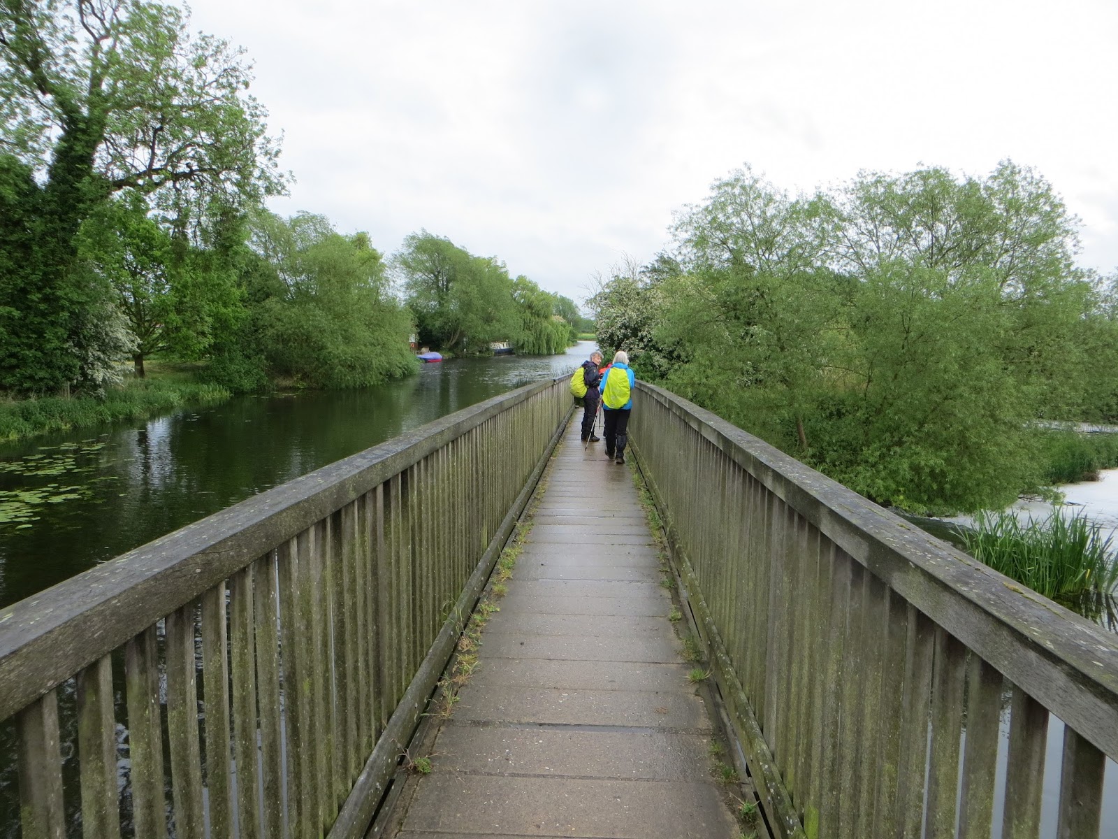
You then head for Newfield Colliery - the site of an old colliery and now a nature reserve. Here you follow the course of an old tramway that took coal from the colliery to the Ashby canal. When you reach the canal you cross by the Moira Furnace Museum and follow the canal past old limekilns. It was lovely by the canal - a nice spot on a sunny day!


Soon after the route leaves the Ivanhoe Way to pick up a footpath following the railway. This takes you across a sports field, before turning under the railway via a big brick tunnel and then along the other side of the railway to meet the road into Overseal.

This seemed like a long section of road walking, but at least we had a pavement! A little footpath keeps you away from the main A road


 and popped out in the road to the community centre where we'd parked! Great when it all works out!

Our walk seemed to have taken longer than we had thought - its always the same! So no time to explore Ashby which is another place to add to the list of places to return to! We headed off to Calke and managed to get rather lost! We had walked out via the exit road so no wonder it didn't look familiar! We finally arrived to find we were still ahead of Irene and Linda - they'd got stuck in Ashby!

Still, we had time to look round the house. This has been left as the National Trust were given it, to 'reflect the demise of the country house'. This is really interesting, the last owner was an avid collector, a nature enthusiast who refused to modernise because of its environmental impact, but who was quite happy to hunt and stuff specimens for the collections! Cases and cases of birds, bees, butterflies..........

The most amazing thing was the 17th C Chinese bed, a wedding present that had never been unpacked as it wouldn't fit! The National Trust lowered the floor and it is now on show in carefully monitored conditions - its beautiful. What a find! Another place to come back to when there's more time!


Wednesday 17th May 2017 Diseworth - Ashby-de-la-Zouch - 14 miles


Wednesday 17th May 2017  Diseworth - Ashby-de-la-Zouch - 14 miles


Well, the day dawned grey and wet with the forecast dismal for the entire day! We'd planned a longer section for today plus a shorter section for the next day, so even if we swapped the route around we were going to get wet! And of course there were no guarantees tomorrow would be any better! So, over an excellent breakfast, we decided to go for it anyway! Hindsight is a wonderful thing!!

So, slightly later than planned, what else, we set off for Ashby to leave a car before heading back to Diseworth to resume at The Plough. Parking at Ashby proved challenging, but we finally found a long stay provision next to a hotel not too far from the High Street.

It was still raining as we arrived at Diseworth, but another quick coffee and off we popped, all swaddled up in our waterproofs!


Following the lanes out of Diseworth, you take a farm track before heading off across fields.

This now meant that we were getting wet upwards from the grass as well as downwards from the rain! This was then improved by having to cross several fields of head high oil seed rape!


Yes, there was a path of sorts, but foliage has a way of spreading out! As we finally crossed the stile out of the offending fields we realised we'd lost Irene! Peering back over the stile, there was no sign, but a little voice answered our shouts! She'd slipped over and disappeared totally - losing all sense of direction as she stood up. Fortunately, she wasn't hurt!

Past the village of Tonge, the route was a cycle track, a former railway track. Cheered by the easy surface, we rattled along, only to realise we'd gone too far and had to retrace our steps! We finally made it to the lanes that take you into Breedon-on-the-Hill - the church perched high on an inland cliff top!


And yes the route takes lanes and then footpaths to CLIMB up to the church!

We stopped at the church to gather ourselves after the climb (still raining!) and to look at the 8th/9th century carvings incorporated into its structure!


We followed the lane down from the church, meeting a woman in a car frantically looking for her dog that had run off. We took her number just in case. We then had to pick up a footpath across a golf course, which was rather unclear, but more by luck than judgement, we arrived at the right place! Over a few more fields, boots now getting rather heavy with mud, and then we picked up a track which turns into a path by Melbourne Pool.


This leads you past Melbourne Hall, to the parish church and out into the village of Melbourne itself.

We would have stayed longer here to explore, but time was ticking away, and the weather wasn't conducive to exploratory strolling (still raining!). You leave Melbourne relatively quickly, taking footpaths that bypass the town to head for Staunton Harold Reservoir. This is quite a well developed site, nicely landscaped and well maintained with a visitor centre and sailing club. The climb up and the lashing rain made the visitor centre a welcome sight, and we stopped for coffee and a snack. By this point, we were seriously considering calling a taxi to take us on to Ashby as we knew we had at least another 5 miles to walk - Linda by now was totally sodden! However, a slight easing of the rain and feeling a little refreshed, we decided to carry on.

From Staunton, you follow round the lake, through trees to head towards pools and woodland on the Calke Abbey National Trust Estate,


 taking you all the way to the house itself. From there, the route follows the driveway through the estate, right out to the hamlet of Calke.

You then follow the road until you pick up the the Ivanhoe Way, which will take you all the way to Ashby. This made the route easier to follow, but it was still dis-spiriting to pick up a marker saying Ashby 3 miles! We all felt it should be closer! Never mind, we all plodded, literally, on and finally made it into Ashby despite having to navigate a footpath diversion!

Fortunately, the circles we had driven in, trying to find parking in Ashby, gave us the familiarity with the area to cope with the diversion! Everything happens for a reason! Still trying to work out why we had to get so very wet though! But we did enjoy our evening meal and drinkies once we made it back to the hotel; and had dried out a bit! Our rooms looked like laundries - there were bits of kit everywhere!!


Tuesday 16th May 2017 Wymeswold - Diseworth - 13 miles


Tuesday 16th May 2017  Wymeswold - Diseworth - 13 miles


Our final away trip in the East! Our plan was to cover almost 30 miles this trip, to leave roughly 8 miles which we could complete as a day trip. Time always seems pressing and we could only spare 2 nights away.

Anyway the day dawned fair, and we set off to rendezvous at Diseworth to leave one car, before heading back to Wymeswold to start.

After the nightmare of the last trip east, all went relatively smoothly and we met at the Plough Inn in Diseworth. This, very conveniently, was right on our route and was just opening! They were happy to let us park, so after a quick coffee, we set off for the lay-by in Wymesworld.

Wymesworld is lovely but the main A6006 runs right through the centre. You walk right through the village, but soon after leave the main road, initially on lanes and then over fields. The route follows the stream, which at this point marks the boundary with Nottinghamshire and Leicestershire.

As the route meets and crosses the A60, you cross the stream back into Leicestershire. Soon you head away from the stream, uphill, to meet a bridleway which runs along the ridge of Hoton Hills, giving great views,


before dropping down to the lane which takes you into Stanford-on-Soar and back into Nottinghamshire!


From Stanford you follow the River Soar over fields, crossing a railway, and on, to go under another railway line via an old brick tunnel. The route runs parallel to this railway to meet the road running into Normanton-on-Soar. However you soon take a footpath which runs closer to the river and leads through an area of 'holiday huts'.


Chalets would be an exaggeration, but they are obviously used for holidays despite being rather small and simple. There is also a ferry which looks more like a large wooden raft hauled by chain!


A wooden gate takes you across the private garden of a very 'Grand Designs' property and into the churchyard at Normanton-on-Soar

After walking through the village, you head across fields again, to reach Zouch. Here you cross the weir on a maze of bridges back into Leicestershire.


A footpath then leads you to the lane into Hathern, another lovely village. Here we stopped to buy drinks at the Post Office,


before heading on through the village and down a short section of the A6, before crossing into the lane that would take us all the way to Long Whatton and most of the way back to Diseworth. After this longish road section, you take a footpath across fields into Diseworth.

This wasn't easy to spot - it felt like disappearing down a rabbit hole! Luckily the directions proved easy to follow and it wasn't long before we could see the spire of Diseworth church guiding us back into the village and the Plough Inn.


It felt like a long day, but we stopped for a drink at the pub and I think that we gate-crashed a wake! There was obviously something going on, complete with food and an Elvis impersonator, but there were some people obviously upset and some strange floral arrangements, one of which looked just like one you would put on top of a coffin?! I hope our presence didn't offend anyone. We just needed a drink and wanted to give the pub our custom.

Back to Wymeswold and off to our hotel. Very nice. Very welcoming. Once again, no time for the spa, our mileage had been ambitious for a travel day, but a lovely meal and a little drinky or two!


Tuesday 11th April 2017 Stathern - Wymeswold - 17 miles


Tuesday 11th April 2017  Stathern - Wymeswold - 17 miles


After the tribulations of the previous day, we decided to take it on the chin, and still head for Wymeswold so that we would still cover a projected 22 miles this trip. This meant a longer walk than planned today but we'd got all day and could make an early start.

Well, we could, but breakfast was a bit of a leisurely affair and its so good to be on the trail again! Anyway, we set off, not quite as early as planned, to resume at Stathern.

You leave the village on a wide, easy-walking track, before heading off across fields to drop out onto a road. Not sure we got that quite right, but we ended up on the right road, so all good! The road verges were rather bumpy and some nasty bends, but after a sharpish pull up you head off across country again.

An access track takes you onto a good grassy path across pasture, then down through a copse - bluebells just coming and out across pasture land until you hit a track which you follow into Hose.

Hose is another charming village, the pub seems more of a restaurant than village pub these days, so we stopped for coffee on a bench on the road out of Hose on the way to the canal.

The next part of the route took us along the towpath of the Grantham Canal again, which we had left at Woolsthorpe-by-Belvoir. The towpath is well maintained and its a pleasant section of the canal, open, bright and sunny. It would be a good section to travel, if they can bring plans to make it navigable again to fruition. 3 miles plus of flat, easy walking, but it made my legs ache more than climbing!


The canal takes you all the way to Hickling, a bustling village. A lunch stop at the welcoming pub by the canal and then off again, initially through fields to the ridge of the Hickling Standard.


Following this ridge took us past the trig point and gave cracking views. We met a farmer on this ridge who was very amused to watch us negotiate the only really muddy patch we had encountered!

We were on the right path, but apparently not many venture this way - or not that he had seen! Apparently there are Roman remains on this ridge - which makes sense given the views.

The route continues along the ridge until you meet the A606, which you follow briefly until you head off down a quiet lane. This takes you straight on, over a railway bridge to pick up field paths again towards Willoughby-on-the-Wold.

To cross the busy A46 you end up walking a lengthy stretch of road which was quite busy in the early evening! From here you take a footpath which takes you into the centre of Willoughby.

Walking right through the heart of the village we passed a mobile fish and chip van doing a roaring trade. If we hadn't already booked our dinner, it would have been very tempting - time was creeping on!

Instead we headed on out of Willoughby towards Wymeswold, soon to meet the road again. This was our final section of road walking before we took footpaths across fields. This last section seemed hard as the light was starting to fade! In reality, it was probably not harder at all, but we were tiring and each stile seemed to get bigger!


We finally hit the lane down into Wymeswold, turning at the main road off the route and back to the lay by where we had parked. Here we found the mobile chippy once more! Again we resisted temptation to head back to the hotel.

A successful trip, with 23.5 miles of our route covered, but we felt a bit rushed! Probably having to forego relaxing in the Spa!

Fortunately, with our mileage done, we could visit Woolsthorpe Manor, birthplace of Sir Isaac Newton and then Belvoir Castle on our way home next day!


Monday 10th April 2017 Woolsthorpe By Belvoir - Stathern - 6.5 miles ish

Monday 10th April 2017  Woolsthorpe By Belvoir - Stathern - 6.5 miles ish

Hooray, off walking again. Marie and Irene safely back, so off we go. An early start, as we planned to make the most of the lighter nights to cover 10 miles today. Well, it was a good plan. Linda and Irene got stuck in a mega traffic jam on the A38 and we didn't start walking until 4.30 pm!

Marie and I visited the pub in Stathern twice for coffee and drove round identifying different parking places as our end point for the day got closer and closer to Woolsthorp!

Stathern seemed the best end point, there didn't appear to be many stopping off opportunities as the route goes cross country after Woolsthorpe.Another plus was the opportunity to park on the track the route follows as you leave Stathern, so no extra miles and at 4.30 pm that was a big consideration!

So, after finally meeting up in Stathern, we returned to The Dirty Duck in Woolsthorpe, by the canal, to resume our walk. The pub was closed, which was probably a blessing! Please note, if walking in this area, lots of local pubs seem to close on a Monday!

At 4.30 pm, with a predicted 7 miles to cover, we set off at a cracking pace (for us). The route takes you down through the village, then up across beautifully manicured fields with views of Belvoir Castle on the hill above.


You circle around this to pop out on to the road through the estate, which you follow until the Jubilee Way footpath takes you off up across the Terrace Hills.


We were dreading a climb, but the footpath is good and its quite a gentle gradient with good views on both sides. Eventually you meet woodland as the path goes down and up again, until you reach the obelisk in a clearing on Beacon Hill. This was one of the chain of beacons used to give the alert of the Spanish Armada in 1588, being one of the highest points in the area.


The route continues to follow the Jubilee Way, until it meets Taft's Lane (more of a track really) which takes you down to the village of Stathern.

Stathern is a lovely little village. The Red Lion is currently closed, but The Plough and the village shop are still there and the church, St. Guthlac's, is small but interesting.


Fortunately, the walk came in at less than 7 miles and the evening was bright, but it felt like a bit of a yomp! We finished in good light , but still had to retrieve the second car and head on to our hotel in Grantham. No time for a visit to the Spa - it was straight to the bar!


Monday 6th February 2017 Cranberry Rock - Stiperstones Inn - 3 miles ish

Monday 6th February 2017  Cranberry Rock - Stiperstones Inn - 3 miles ish


The weather forecast looked reasonable so we thought we'd head out and see if it was possible to fill in this section before two of our company headed down under for two months! The gap on our map was annoying all of us!

As we were a bit pushed for time, and being wary of the weather, we decided to set it up as a 'hop' with a car at either end, but had also planned a circular route that we could complete to give us a bit more of a walk.

It was cold and a bit misty at Cranberry, but nothing like the last time, so off we went. The ridge path is pretty well defined, but as you near Manstone Rock the going underfoot is tough - lumpy, uneven rock - which slows you down and makes you watch where you're stepping!


Its worth stopping and looking up however, the views to both sides are amazing even on a grey day.


Any mist about was moving quickly so it was easy to pick out landmarks to check progress and location.

As you head past Scattered Rock towards Shepherd's Rock, the path becomes less rocky and as you turn to start to descend Perkins Beach the landscape changes dramatically. From windswept gorse and heather covered rock, it changes to grass and bracken between moss covered stone walls under ancient trees.


The path winds down around Green Hill, dropping into Stiperstones Village itself with the very welcoming Stiperstones Inn. With one car parked here, we had 'Elevenses' waiting for the pub to open for coffee!

Having filled the gap in our Cross Britain Route, Marie headed for home, whilst the rest of us decided to extend our outing by completing a circular route back to Cranberry Rock. Fortunately, map reading went better today and we arrived back without mishap and just before the rain!

There will now be a two month lay off in our project whilst Marie and Irene have their big adventure, but we're due back in Grantham on 10th April. We've got approximately 62 miles to complete between Woolsthorpe by Belvoir and Barton under Needwood, and then 68 miles from Welshpool to Barmouth.

So roughly 150 miles done, 130 to go! Over halfway.......


Monday 30th January 2017 Brockton - Welshpool 9.5 miles

Monday 30th January 2017  Brockton - Welshpool  9.5 miles


The last part of this stage of our journey and into Wales. Today we should cross the border!

Another early start as we headed out to Welshpool. Finally, after initial confusion as to which car park we were using in Welshpool, appalling map reading in the car on the hop by yours truly and getting stuck for 15 minutes at roadworks, we finally made it back to Brockton to rejoin the route. So much for an early start!

The guide gives lots of instructions for this section, so clutching both the maps and instructions, we set off! You start by crossing a farmyard and going past a barn - hence the need for the directions to make sure you get the right one! All good and then across fields. The ground was really saturated, so in no time, ten ton boots again!

You drop down to the field edge to follow Brockton Brook, then come out into a lane, before crossing into Beechfield Dingle to follow the brook again on the opposite side. The Dingle is lovely and the guide promises bluebells and wild garlic in Spring! We did find the first showings of Snowdrops!

The path winds through the dingle, really soggy and boggy at the moment. We were all glad to use our walking poles! Eventually you drop out onto a track which bears round, re-crossing the brook, to head up towards the lane again.

Before you reach the lane, you head off across fields, travelling parallel to the lane. It helped to see this on a map as a rise in the centre of the field made it hard to pick up the next 'marker'. This was the 'wired up gate' which the guide promised would be rectified, but clearly hasn't been! The gate itself is fine, but about two feet in front of it is a fence of a single strand of barbed wire just below chest height. We limboed under and headed onward. At least the warning of a bull in the field was unfounded.

You then re-join the lane to head up Belan Bank towards Walton Hill. This is a climb! At least it was easy underfoot and the views would be stunning on a clearer day! Yet another grey, murky day but at least not raining though the damp in the air was curling the map edges! The lane gets really narrow - fortunately the tractor driver saw us and waited patiently for us to walk past - it was steep!

The lane just ends and at a gate you head across fields again still climbing but less steeply towards Walton Hill. You don't quite reach the crest, but drop down to pick up the Offa's Dyke footpath that takes you up to Beacon Ring. It is here that you finally cross into Wales.


Beacon Ring is an Iron Age hill fort which was planted with trees in 1953 to commemorate Queen Elizabeth II's coronation. We somehow managed to be on the wrong side of a hedge line but a quick scramble sorted that!

You skirt around the hill fort and continue to follow Offa's Dyke through conifers and then across fields to make the long, steep descent down into the valley of the River Severn.Again, following such a major route, you expect the way to be clear, but thick trees and sloping across ploughed fields can be distracting, but four pairs of eyes and a map kept us on track. It isn't until you come down that you realise just how high up we had been, but the route drops all the way into Buttington on the main road into Welshpool.

Unfortunately the pub was shut, so we stopped for lunch at the church, sheltering in the porch.


This is a very simple little church, which we've all passed many times and never really given it a thought. The Yew trees were really amazing.


From Buttington you cross the railway, and then join the main road at the iron bridge that crosses the River Severn.


You never really notice the bridge - you're too busy negotiating the bends when you're driving and its narrow!
There's no footpath here, so you have to pick your moment to cross the bridge!

Here you leave Offa's Dyke and follow the road towards Welshpool before heading off to pick up the Montgomery Canal. This is very well maintained, with an excellent towpath, and gives a really pleasant, interesting walk on onto Welshpool.


We'd made it - Welshpool before the end of January.